Monday, September 02, 2013
Sunny - it poured rain the day before but today the sun was out - our guest are leaving after lunch - so I wanted to go for a hike. The book says it will take 6 hours and people on geo caching say it takes 3 - 4 hours. I think I will believe the longer - i am not so fast going down mountains.
I leave right after I serve lunch leaving Noni and my new dishwasher to clean up to go trekking 12k into the wilds of BC.
I get stuck behind cars that are driving 40 in a 80 km route - then I hit every red light on my way - all four of them... Finally I get to the place I need to park the car. I am not sure where the trail head begins -all I know it is across the highway and I need to walk along the road for a bit before it turns into the woods. I do this -- I see red flagging tape - ah this must be it. i follow this into the woods - up a very steep incline - ( I am told it is steep at first) over boulders roots - fallen logs - I am concern - this is not safe - if this is the trail I am not going to do it - it is dangerous - I decide to turn around -- I get back to the road with some fearful moments --
I decide to walk a little further along the road - there must be another proper trail head --- sure enough a few yards more there is a sign hidden just off the road and a very well worn path leading up with orange tags in the trees marking the route lays before me. It only took me 1 1/2 hours of going the wrong direction to find this trail. There is no way I will be able to hike to Petgill Lake this time - but I am off to find two geo caches closer to the beginning of the route about 1500 feet in as a bird flies ..
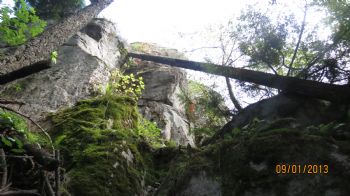
I am already very wet and exhausted as I start on the proper route but I am determined to find a cache this day. It is another steep incline - but well marked and a decent path to follow - there is even a chain securely attached to a boulder to help get you up and over - (down) one particular spot that requires hands and feet to get over.
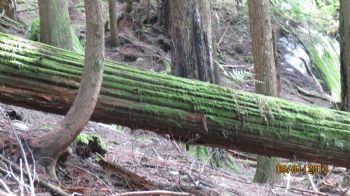
I am hiking along at a fairy fast pace - there I see the tree log that is described in the hint of the Geo cache that I am seeking. I need to change my batteries of my GPS - this done - well it takes a very long time for my GPS to reconnect to a signal from outer space and do what ever it does to align organize the caches I have up loaded to it.. I spend at least half an hour here searching for the cache - but I do find it ... when I get home that night - I see from a picture I took before I found the cache when I first came in sight of the fallen tree the cache - how did I miss it - I spent a lot of time looking all around this place..
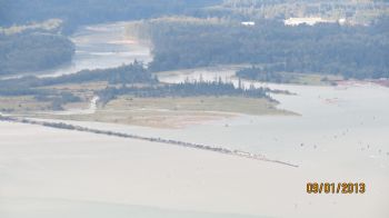
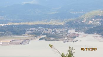
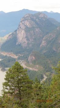
Then off I went to find the next one - the last two people could not find the cache - but they are newbies and so with their inexperience just maybe they missed it -- I looked and looked - NO I could not find it either - but the view was awesome
Time to go home - the trail was good - then I got confused - the last section was very tricky and the most dangerous - down the bluffs to the highway - there were three possible trails to follow and I scouted them all before I found and recognized the proper one - relief to get down the final drop to the level area and back to the road and the car..
Left camp 1:50 - parked car 2:25 - walking 2:30 -- back at car 7PM- back at condo 7:45
I wore short pants - it was 26c - hot - my legs are all scratched to hell - I look very whipped..
I leave right after I serve lunch leaving Noni and my new dishwasher to clean up to go trekking 12k into the wilds of BC.
I get stuck behind cars that are driving 40 in a 80 km route - then I hit every red light on my way - all four of them... Finally I get to the place I need to park the car. I am not sure where the trail head begins -all I know it is across the highway and I need to walk along the road for a bit before it turns into the woods. I do this -- I see red flagging tape - ah this must be it. i follow this into the woods - up a very steep incline - ( I am told it is steep at first) over boulders roots - fallen logs - I am concern - this is not safe - if this is the trail I am not going to do it - it is dangerous - I decide to turn around -- I get back to the road with some fearful moments --
I decide to walk a little further along the road - there must be another proper trail head --- sure enough a few yards more there is a sign hidden just off the road and a very well worn path leading up with orange tags in the trees marking the route lays before me. It only took me 1 1/2 hours of going the wrong direction to find this trail. There is no way I will be able to hike to Petgill Lake this time - but I am off to find two geo caches closer to the beginning of the route about 1500 feet in as a bird flies ..
I am already very wet and exhausted as I start on the proper route but I am determined to find a cache this day. It is another steep incline - but well marked and a decent path to follow - there is even a chain securely attached to a boulder to help get you up and over - (down) one particular spot that requires hands and feet to get over.
I am hiking along at a fairy fast pace - there I see the tree log that is described in the hint of the Geo cache that I am seeking. I need to change my batteries of my GPS - this done - well it takes a very long time for my GPS to reconnect to a signal from outer space and do what ever it does to align organize the caches I have up loaded to it.. I spend at least half an hour here searching for the cache - but I do find it ... when I get home that night - I see from a picture I took before I found the cache when I first came in sight of the fallen tree the cache - how did I miss it - I spent a lot of time looking all around this place..
Then off I went to find the next one - the last two people could not find the cache - but they are newbies and so with their inexperience just maybe they missed it -- I looked and looked - NO I could not find it either - but the view was awesome
Time to go home - the trail was good - then I got confused - the last section was very tricky and the most dangerous - down the bluffs to the highway - there were three possible trails to follow and I scouted them all before I found and recognized the proper one - relief to get down the final drop to the level area and back to the road and the car..
Left camp 1:50 - parked car 2:25 - walking 2:30 -- back at car 7PM- back at condo 7:45
I wore short pants - it was 26c - hot - my legs are all scratched to hell - I look very whipped..
No comments:
Post a Comment